
- Number 288 |
- June 8, 2009
Scientists diagnose role of clouds in climate
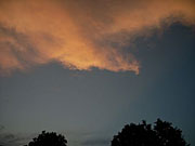
Cloud imaging could lead to more
accurate weather and climate
predictions. Photo: M.G. Wells
Scientists from Brookhaven, Argonne, and the University of Colorado are teaming up to make high-tech scans of clouds. The research, conducted at DOE’s Atmospheric Radiation Measurement Climate Research Facility in Oklahoma, could lead to more accurate weather and climate predictions. The team’s “cloud tomography” approach is similar to x-ray computed tomography, used by doctors to diagnose disease, but this time the “patients” are clouds. Multiple microwave sensors will scan the clouds from several ground locations to “map” three-dimensional cloud characteristics over a 10-kilometer region. Combined with other data, long-term observations, and modeling, the findings should improve weather forecasting and climate modeling.
[Karen McNulty Walsh, 631.344.8350,
kmcnulty@bnl.gov]