- Number 394 |
- August 5, 2013
Tracking Greenhouse Gas Emissions with Satellites
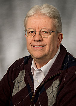
David Streets
Tracking Greenhouse Gas Emissions with Satellites
Argonne meteorologist David Streets leads a team of researchers from around the country who use satellite data to track greenhouse gas emissions from around the world and monitor how they contribute to climate change. Here’s a brief glimpse into how the process works:
How can satellites provide a detailed picture of the atmosphere?
You can see the whole surface of the earth pretty much once per day. Now, it’s not truly “everywhere,” because you may have cloud or snow cover over a particular region, but if there’s a clear day over North America then yes, you can see the entirety of the United States and all the significant emissions sources in the period of a single day.
The advantage of this comes from the fact that the EPA maintains a national emissions inventory that comes from data reported to them by the various states. Unfortunately, this inventory is updated only once every three years or so, and in fact the last update occurred all the way back in 2008. So, as you might see, we don’t always have a very recent picture of the exact location and the quantity of the emissions, especially considering we might be able to take new data every day.
Satellites also give us the opportunity to detect what we call “aggregate” sources like ammonia and methane that have a weaker signal but are generated over a larger area. The EPA doesn’t quite have a handle on how to compute these emissions yet, but it’s possible for us to get a better picture from space. With satellites, we can see both big individual point sources and large areas of aggregate weak sources.
How have emissions sensing projects changed with the evolution of satellite technology in the past 20 years?
There were some satellites being used for this purpose before the early-to-mid 1990s, but their results were much more crude and lacked the resolution of today’s measurements. The relative ability to detect different kinds of emissions at different scales is a property of the detector itself.
While there has not been a lot of recent improvement in the detector technologies themselves, there has been a breakthrough in the techniques that researchers use to analyze the data that we have collected. We’ve begun to use a method called oversampling, in which we look at the data we’ve taken in finer resolution and re-aggregate it.
Have any of the results of these studies begun to influence policy?
One of the clear goals that we stated when we began this project was to help air quality managers improve the national emissions inventory, and there was also a lot of interest by state and regional EPAs who wondered if we could say anything with confidence about local issues in their state.
In one example, Oklahoma’s government contacted us wondering if we could see from space the greenhouse gas emissions resulting from oil and gas drilling activities. In some of these activities, like fracking, the methane levels and the nitrogen oxide emissions from the diesel engines used on-site do have weak but detectable signatures. Having the ability to adequately assess and monitor these sources is exactly what we’re aiming for and it’s something that all parties—the air quality managers and the scientists—think is worthwhile.
Additionally, some big sources of emissions are located overseas, and the resulting pollutants can spread around the world in a few days’ time. Figuring out the additional impact of those emissions could represent another area in which we might make a difference.
What improvements might we expect in the next few years, and how will they benefit this kind of science?
We’re looking forward to a new generation of geostationary satellites that will give us even more accurate measurements of the quantity of greenhouse gases being produced in different regions. NASA recently announced a mission called Tropospheric Emissions: Monitoring of Pollution, or TEMPO for short, that will provide detailed analysis of North American greenhouse gas emissions. TEMPO will be launched on a commercial rocket in about five years or so, and we hope that it will ensure the continuity of measurements that we’ve been taking for the past several decades.
The next steps involve getting quantitative about under what conditions—and under what uncertainties—we can make estimates about sources of emissions and how they change over time. We want to be able to give policy-makers an idea of how all of these sources—power plants, cities, oil and gas drilling sites—combine and also compare them to the facts on the ground. When we take these measurements, we’re looking through a column of air, and there can often be a lot of interference that “muddies the waters.”
Essentially, we want to get better at the business of making predictions, because in the end that’s what makes it relatable to people’s lives.
What’s Argonne’s specific role in this endeavor?
NASA has created a consortium of scientists from universities and government called the Air Quality Applied Sciences Team, or AQAST. There are about 20 members in all, and the goal is to try to make our scientific products more manageable by the larger regulatory community.
The science we’re doing is incredibly sophisticated, so it requires an interface between scientists and regulators. Since I’ve done work in both of these areas—I actually used to work for the EPA—NASA looked to me because I could speak both languages.
I’m also the only representative on AQAST who has worked directly on emissions, so it falls directly on areas in which I have experience. From my perspective, I’m very interested in how we could help to reshape the National Emissions Inventory and provide new algorithms and datasets to give regulators better information to go on.
See more at: http://www.anl.gov/articles/qa-satellite-based-emissions-tracking#sthash.VS1CQt2u.dpuf
Submitted by DOE's Argonne National Laboratory